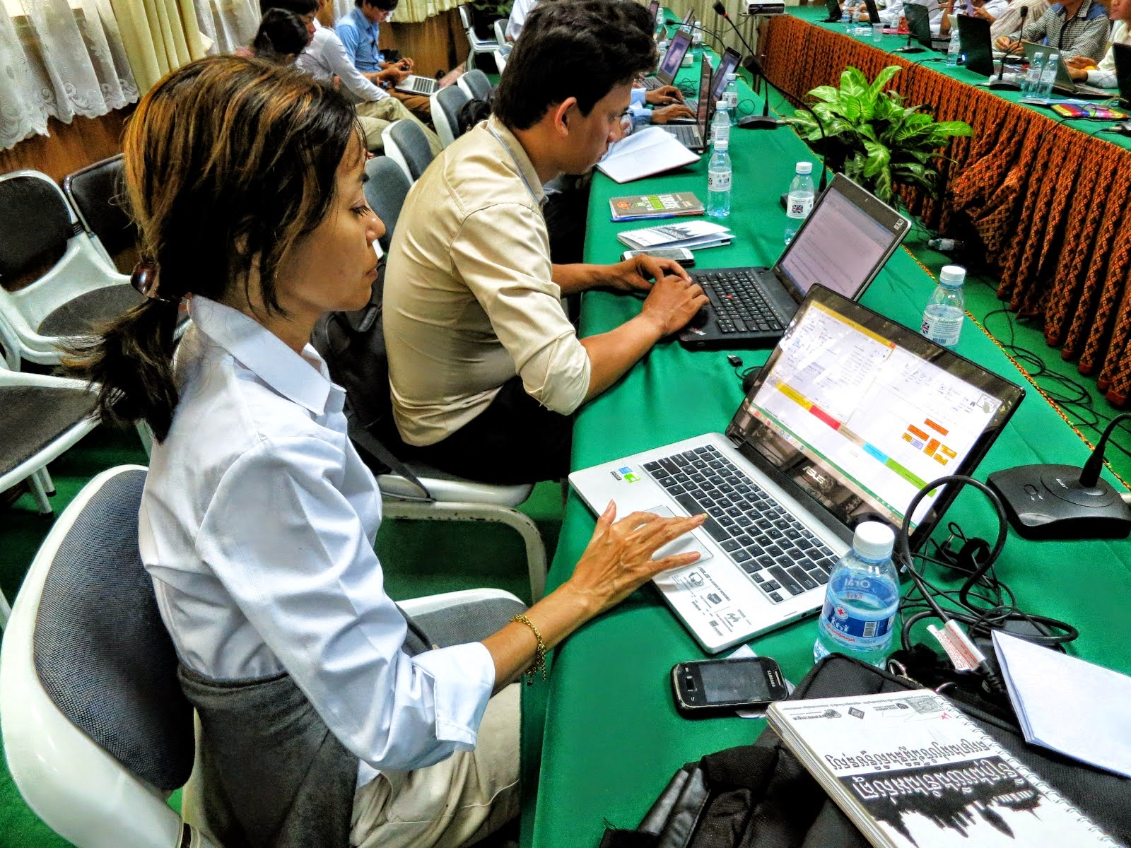
13/11/2019

THE END

Since I pensioned in 2015, I hardly ventured into QGIS because of my personal obligations and commitments, furthermore, I noticed my services in this specialized field were not required anymore both from the public and private sector.

I still do update myself on QGIS once-in-a-while like I am now aware Quantum GIS is now officially called "QGIS". They also changed their logo to a more attractive modern design, the number of QGIS plugins has much increased and they have made newer release more user-friendly than before.

I also note Open Source Software has developed rapidly over the recent years as it is being more exposed and is becoming more popular as potential users become more open and welcoming. Even I migrated from my favourite Ubuntu to Linux Mint as my main desktop operating system whilst I use a dual boot OS system. (Wifey still requires Windows for her work).

UPDATE:



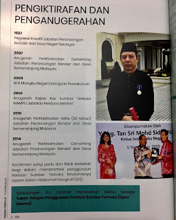
7 years after I pensioned, in January 2022, I received the above half-an-inch A4 document from my old department which it too had rebranded itself as "PLANMalaysia". In commemoration of its 100th year existence in November 2021, that document which highlights the department's figureheads over the past 100 years was initiated. It contains 2 sections: firstly, the 13 Director-Generals who had and still serve the department until today, secondly, 9 selected figureheads which had shaped development of town planning in their respective interest, of which I was surprised but greatly honored to be one of them  where I was officially endorsed by the department as the "Pioneer in the use of Open Source Software". Sometimes, one only gets to see what destiny holds after one has retired from government service. Ah well, another feather to my cap.


02/01/2017

Que Sera Sera...


For the record, I retired in March 2015 and am taking it easy. As days go by, it appears my services are not required so I concentrate on my family and health as health is wealth. Along the way, while spring cleaning my Google Drive, I accidentally deleted many images which were linked to my blogspots. I've been too lazy to update them, furthermore some were originals and I do not have backups. Just be thankful the rest is there. Best of luck.

11/01/2016

What is the best GIS Desktop software?


Monde Geospatial at their FB site just announced that is it "QGIS". As this is from an independent party and not from me, I am so thrilled to read this news. Alhamduillah, Allah has guided me in selecting QGIS to promote to the Malaysian public sector. I am at peace with myself that what I championed for all this while was right all along.

26/08/2015

Raster Clipper and Raster Contour


For one who hardly ventures into raster GIS, I gave QGIS raster tools a try. I downloaded a natural earth file then panned over to Malaysia and zoomed-in farther. Raster data is heavy so it is wise to clip unnecessary area away and using the the Clipper, it worked fined then for the heck of it, I tried the Contour and even that worked out fine. I must say, QGIS is very user-friendly here but I must admit one has to use some common sense to choose the appropriate places to click and get results. I also found it easiest to increase the number of contour lines simply by reducing the number of intervals say shown below from 10m to 5m to 1m though it can get to be a bit jagged when the contour points are too far apart as shown by the 1m intervals.


15/04/2015

Training: QGIS training to MBSA, Shah Alam 24-25.3.2015


This represents the last QGIS training whilst I was in government service before I pension early this year. I must say the staff of MBSA were very enthusiatic about learning how to use QGIS and like many, were impressed that is not such a difficult software to use ...after some formal training to guide them across. And like always I told them, practice makes perfect and I do not expect them to be good at it until they use it daily for a month as most of them are even still new to the world of GIS. 

Asmaniza Adzi
QGIS mesra pengguna, menarik, senang dan mudah digunakan

Azliyana Abd Halaim
Mudah dugunakan apabila mendapat latihan yang chukup

Nurul Qalby Abdullah Sani
User-friendly, sangat mudah difahami dan mudah digunakan. Ianya satu perisian yang bagus dan menarik

Zuhaili Badianahan
QGIS merupakan perisian yang boleh baca semua persiaan seperti ArcGIS , MapInfo dan sangat berguna untuk perancang bandar

Shazana Mohd Noor
QGIS sesuai digunakan dan mudah. Perlukan lagi kkursusQGIS ini untuk menamahkan ilmu untuk penggunaan perisian ini.

Muhammad Nizam Md Yusof
Mudah dan cepat

Siti Azliza Ahmad
Mula-mula tak faham, se;epasa dah buat latihan dan diberi penegerangan QGIS ini mudah dan cepat dan sesuai digunakan dalam bidang perancnagan.

Syamrul Nizam
Sesuai digunakan , mudah difahami dan cepa

Abdul Aziz
Sangat mudah difahamai dan yang paling penting adalah ianya percuma.

Ahmad Nazmi
Perisian yang mudah digunakan dan difahamaioleh pengguna. Akan tetapu memerlukan kursus/latihan lanjutan untuk lebih mahir

Mahazir Jais
Software yang memdudahkan kerja GIS

Shahril Bashar
Mudah untuk digunakan

26/03/2015

I-PLAN and QGIS

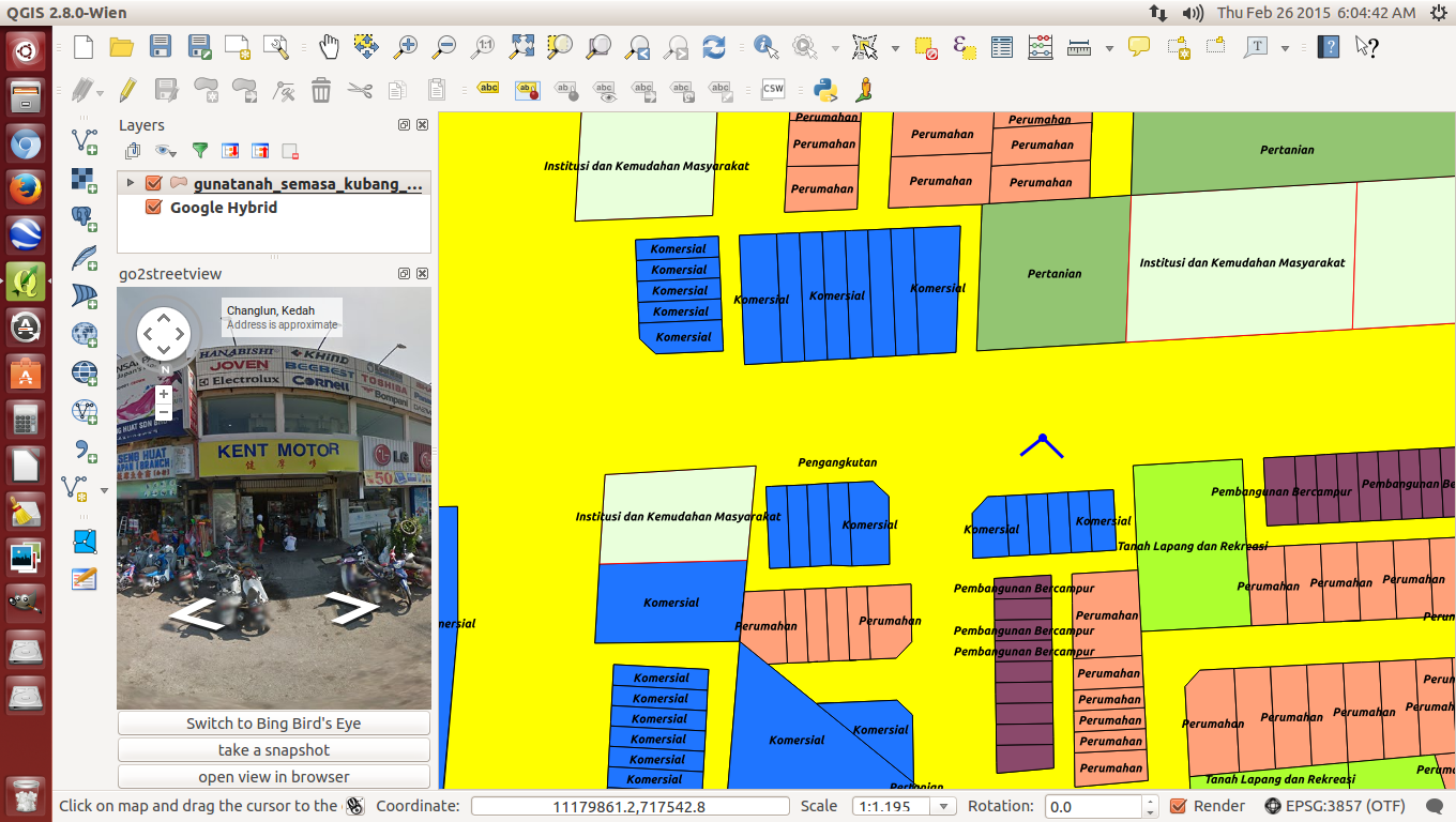
An existing landuse plan using I-Plan qml planning colour template
QGIS Ver. 2.8 shows  I-Plan existing landuse compatible with Google Hybrid
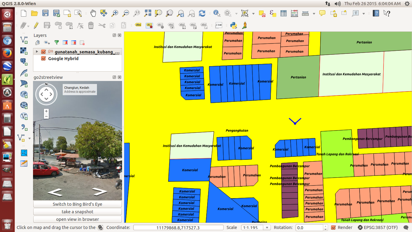
Go2streetview works well on top of the landuse map with Google Hybrid underneath

In a nutshell, the Federal Department of Town and Country Planning (JPBD), Peninsular Malaysia's  Integrated National Landuse Information System (I-Plan) began development in October 2013 and is scheduled to be completed by the end of 2015. This landuse information system utilizes an enterprise relational database management system (RDBMS) linked to a web geospatial aplication for easy and convenient access to all interested parties including public. It is built wholly using Open Source Software (OSS) including Quantum GIS (QGIS) at workstations (initially distributed to every State Planning Department and eventually proposed to be distributed to every local planning authority), Enterprise PostgreSQL-PostGIS for the RDBMS, OpenGeo Suite for the GIS application and Tomcat Apache for the web application whereby the operating system for both server and desktop computer is my favourite Ubuntu (Isn't that a coincidence?). Incidentally, the preference for OSS as against the use of proprietary software saved the total project cost by about RM6 million. The centralized system consists of 7 physical servers and 3 virtual servers incorporating Development, Production, Database, GIS and failover functions. The initial stage involves vertical linkages from all local planning authorities within Peninsular Malaysia to  all State Planning Departments and eventually to the centralized I-Plan system at Kuala Lumpur. In years to come, the system will be extended to horizontal linkages between the I-PLAN system and geo-spatial systems at key government agencies that want to share JPBD's landuse data via map services. The I-Plan project is a massive exercise to coordinate, standardize, collect, rectify topology errors, update landuse data and transform previous landuse maps from the Survey Department's state Cassini Soldner map projections to their Geocentric Datum of Malaysia (GDM2000) map projections. The I-Plan system covers 3 landuse category namely zoning, committed and existing landuse. Map update will be carried out bi-annually beginning 2015 on a district-sharing basis between JPBD departments at the federal and state level to help overcome technical manpower shortage at many local planning authorities mainly District Councils and ensure landuse data will not be obsolete but always up-to-date on a scheduled basis  and accurately recorded. Myself, being as I-Plan Project Manager will not see it complete as I have to call it a day and pension by the end of this month where at this point in time, who will replace me is a million dollar question.

In the meantime,  using the Linux Ubuntu QGIS Ver 2.8 at my office desktop computer, I activated one of the existing landuse maps for a particular local planning authority. That GIS map had already been transformed to GDM2000 map projection. Next, I added the JPBD town planning .qml colour template (which we customized based on the second version of JPBD's GIS manual for development plans) to that map and everything worked out fine. This was followed by activating Google Hybrid. I was expecting QGIS to crash as in previous version because Google Hybrid had to be activated first but no, not this version. It worked out fined again though of course, I had to move the raster Google Hybrid below the vector landuse map. Finally, I activated the go2streetview plugin. At first, I was not expecting it to work as I had the Google Hybrid underneath the landuse map and expected it only to work in synergy being directly on top of Google Hybrid but no, it worked out fine again and on top of the landuse map. As I rotated the view angle, I could see what was around the spot I had chosen to view. OMG, this will surely be a great help to local planning authorities that can now do virtual site visits and save themselves, time, money while enjoying the comfort of their office/home. It makes cross inspection between what is on a GIS map and the site so easy. As a government servant, I wanted so much to make QGIS the principal GIS for the public sector and I believe I have succeeded here, well, give it one or two more years because I-PLAN is making it popular nationwide among local planning authorities, me, having shrewdly defacto-ed it at I-Plan workstations. I look back at when I got to first know QGIS in 2009 and now see the tremendous improvements that have come about especially over the past few years, I must take my hat off to the dedicated developers who made it possible as I am but a humble user.

26/02/2015

How to get help on QGIS fast when there's no one around to help?

Type key words to query
My query already asked and properly phased by someone
Checking info on "Affline Transformation"

I believe like so many of us, this is a common problem among first time QGIS users, that is, getting help on QGIS yet having no one reliable around who can help give advise and direction. Well, then do what I did when I first started to get to know QGIS... help is in actually in front of you if you are sitting in front of an internet computer. (Nowadays, this situation also covers smartphone users). I found that Google's search engine is the most reliable "friend" to guide me in this quest for knowledge. I also I found out from my many training class on QGIS that many people do not actually know how to use an internet search engine intelligently. The trick is actually to enter key words related to one's query but even if you don't even know what that is, type in the Google search engine box a proper question like "What is so and so?" Even the query type: What, When, Where, Who or How helps to further filter the query specifically and that helps to get better results. You can see in the first image, even I was too lazy to type a proper question but because it had key words, that helped a lot. In the second image, someone actually made my life easy and even asked my query as a proper question. Because 2 options were given, I went on further to click on other sites to get more information. Now, it's time for me to read on and see if I can get what I wanted. Wish me luck.

Go2streetview for convenient and lazy armchair monitoring

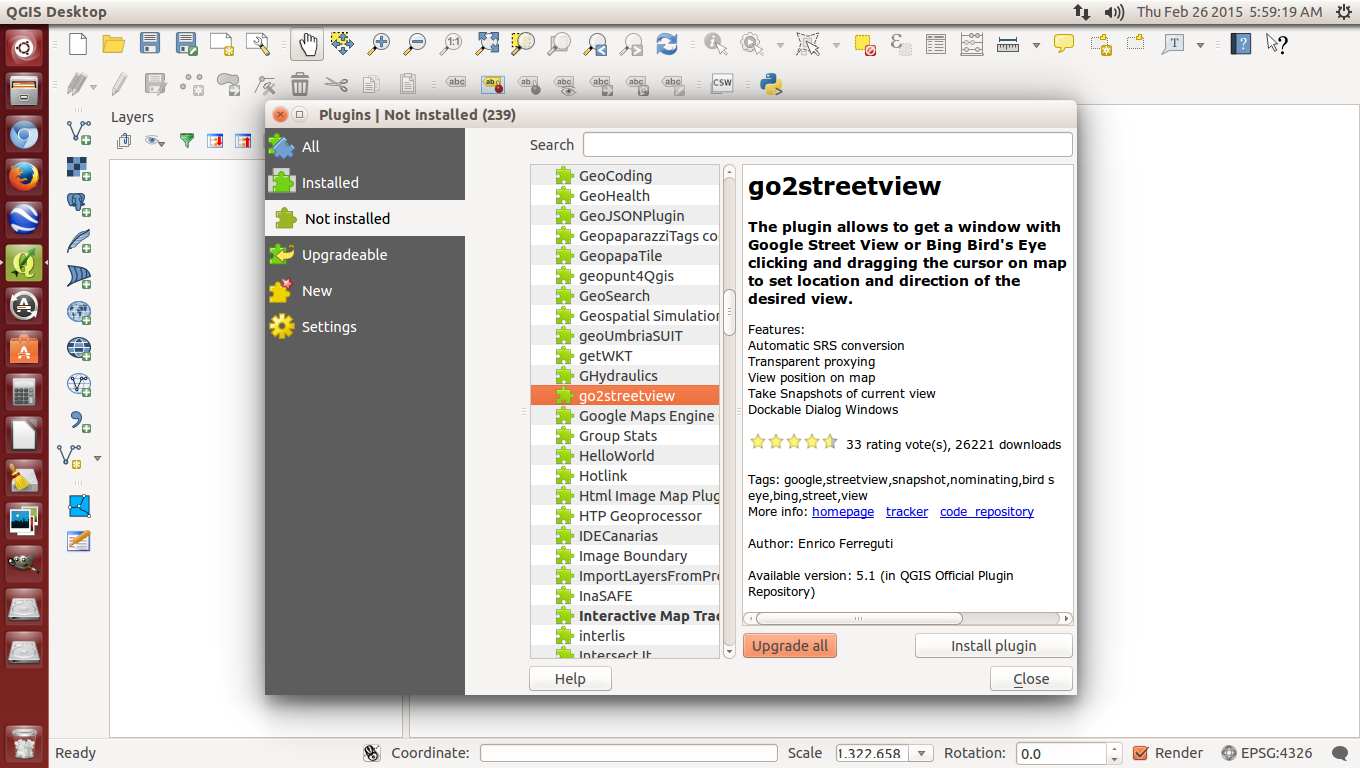
Of course, firstly, the appropriate plugin needs to be installed
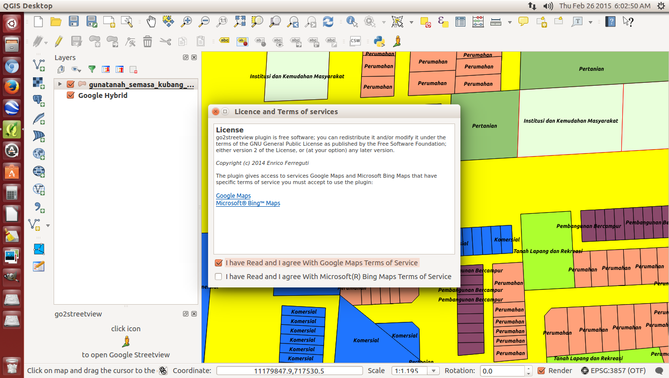
Once activated, just close your eyes and tick the 2 boxes
Click on a particular road and a "north" street view appears on the left
Turn the North of the cardinal points to south for the other street view
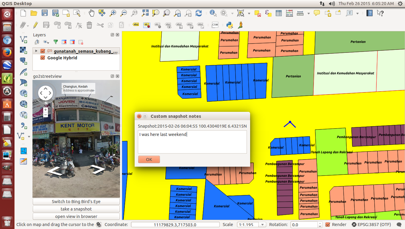
Adding caption to snapshots is also possible
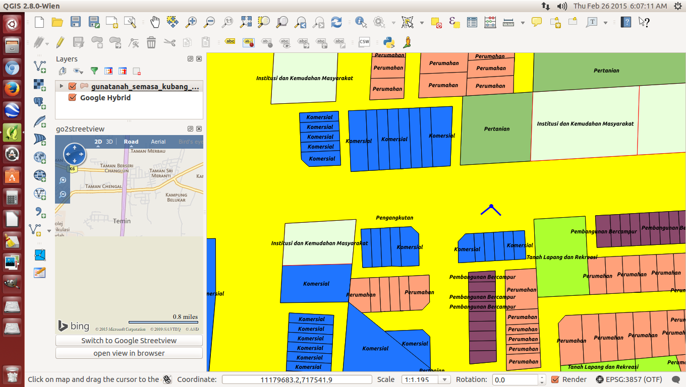
Bing browser also available if you prefer to
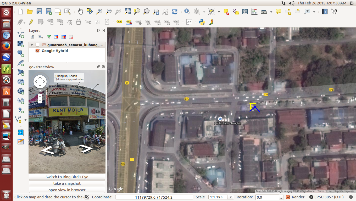
Site location less existing landuse map
Once in a while, I become a busybody and have a peep to see what's new under the Plugins section. WALLA! I noticed a Google's Map street view plugin is available. I don't know how long it existed but I decided to give it a try. As usual, that Go2 streetview plugin needs to be installed. Then, I activated Google Hybrid next decided to activate the existing landuse map, as in this case, for Kubang Pasu district in Kedah. After activating Go2streetview under the Menu bar, I clicked on an existing road because that's the way Google Streetview works where hopefully that road has been surveyed by Google's street view team (I went over to Mauritius and although that country is developed, sadly, the streets have not been surveyed by Google's Streetview team) and a License agreement box popped out. I tried just clicking the first box but the module didn't work so I guess they wanted me to click the second box too. OK!OK! Let's not be too fussy and so I did then immediately a panaromic view angle appeared, by default pointing northwards and the street view could be seen in the box on the left. To see the other views, I rotated the cardinal point knob. All this while, I was surprised that the view angle point could connect with the Google Hybrid map underneath the existing landuse map, I didn't expect that. Cool! Some extras include viewing under Bing browser, taking a snapshot and putting up some comments, if needed. I think this is an excellent tool for comparing and monitoring between Google's maps and a preferred map be it a zoning map or in my case, an existing landuse map. I checked the visibility of the Streetview module and it is so sharp, I am so embarassed to show where my house is because you can even see the cracked tarmac road in front of my gate. I can imagine it is a a great help should the weather rains or in some countries, snows or it's too cold to go outside and one wants to check an unfamiliar site. This tool will surely help cut down petrol bills which is also good for the environment too. Because of that, I got to hand it and take my hat off to the QGIS team that took time and effort to develop this plugin. Simple things mean a lot. It gets my 5***** rating.

22/02/2015

Ubuntu QGIS Ver. 2.8 Wien installed!


Today, just came back from Sunday's grocery, I noticed there was a QGIS update. This rarely happens so it caught my eye so upon download and installation, Walla! I get a Ubuntu QGIS Ver. 2.8. First thing I did was test it and it successfully opened a recent I-PLAN landuse map with an update .qml file that compliments I-PLAN's revised landuse colour code...and it works . Yeaaaah.

10/12/2014

Training: QGIS training to Sabah local authorities, 1/12//2014 - 3/12/2014


Efforts to hold a QGIS training surfaced in April after my department held an exhibition at Kota Kinabalu. The Sabah Town Planning Department followed through and was desirous to sponsor it but was hampered by financial constraint. Still we never gave up, on our part tried and eventually secured the financial resources to hold it which eventually took place at TH Hotel, Kota Kinabalu, 1-3/12/2014. Not including particiants from Sabah Town Planning Department, all local authorities were invited and we saw a mix of participants some were engineers, town planners and of IT background, many of whom were still new to GIS. However, some could not make it because it rained so heavy the first day that our flight was diverted to Labuan airport for 4 hours until the rain lessen which saw some parts of Sabah flood. However, I must say, the course was a success because they were so enthusiastic and kept asking, asking and asking questions and clever me made them make mistakes because I knew only too well that's the way that they'll learn fast. It continued in the night and their attendance was impressive to say the least even to the last day, trying hard to squeeze every bit of knowledge they could extract from me. I know the course which as basic-intermediate was rather heavy for first timers to GIS but I believe I had managed to pass on the fundamentals well. I hope QGIS will spread fast throughout Sabah from now onwards. Hello Sarawakians, what about you guys? Interested?


Isma Syafry
Thanks to En. Abbas Abdul Wahab and the team from JPBD for a job well done. QGIS is very usefull and quite friendly to use. It's just as good if not better as some of the commercial software out there.

Anonymous
QGIS sangat baik dalam kerja-kerja dokumentasi secara lebih teratur dan sistematik cuma minta lebih masa untuk kursus latihan dan praktikal masa akan datang.

Anonymous
QGIS lebih mudah digunakan dan di fahami serta sentiasa berkembang dari segi teknologinya. Apa yang lebih penting penggunaan QGIS dalam sektor kerajaan lebih menjimatkan dan memberi perluang kepada penyediaan hardware dengan lebih baik lagi.

Danny G. F. Malinggi
Kursus QGIS ini sangat berguna dan dapat memberikan lebih pemahaman dalam menggunakan QGIS dengan cara yang betul. Namun masa kursus yang agak singkat dirasakan belum cukup untuk mempelajari dan memahami QGIS sepenhunya.

Zuldahri Tujoh
Mudah difahamai dan user-friendly

Nurul Asykin
Mudah digunakan, sangat menarik dan berguna untuk membantu saya dalam kerja di pejabat dan yang penting FREE!!

Julianah Jimir
Kursus yang sangat menarik. First time pelajari ilmu baru, menarik, mudah FREE. InsyaAllah diusahakan untuk mengimplitasik kemahiran baru ini dalam kerja-kerja harian dipejabat.

Rusli Habe
Kurus yang sangat menarik dan mudah untuk digunakan dan ianya percuma. Saya akan memberitahu kepada rakan-rakan mengenai QGIS

Mohd. Amin
Kursus yang sangat berguna. Pertama kali menggunakan QGIS menampakkan berguna berkaitan kerja saya akan tetapi bukan skop kerja saya. Saya akan mempermosikan kepada kawan-kawan kursus ini perlu lanjutan.

22/11/2014

Raster Terrain Analysis

You have to activate this plugin if you want to use it
GIStutor gives tutorial
Recently, I got a request on how to do a slope gradient analysis and I must admit I am rusty on this one because I left it long time ago way back in 2010. But I looked up the plugins, found and activated the Raster Terrain Analysis plugin because it jogged my mind and I had previously used it and it turned out to be a very simple yet powerful tool. Doing a Google search on that specific plugin, I found a tutorial at GIStutor which looks not bad. Most people when they get stuck in getting help using QGIS often forget that there can be tons of help on the Internet but forget to do a simple but specifically typed out Google search to help them out especially when they are all alone with no one to guide them through. Well friends, that is how I got through on my own and I found out the more popular the subject on QGIS, the more you will find hel on the Internet.

18/11/2014

Free and Open Source (FOSS) GIS Workshop at the Royal University of Agriculture, Phnom Penh, Cambodia, 14/11/2014


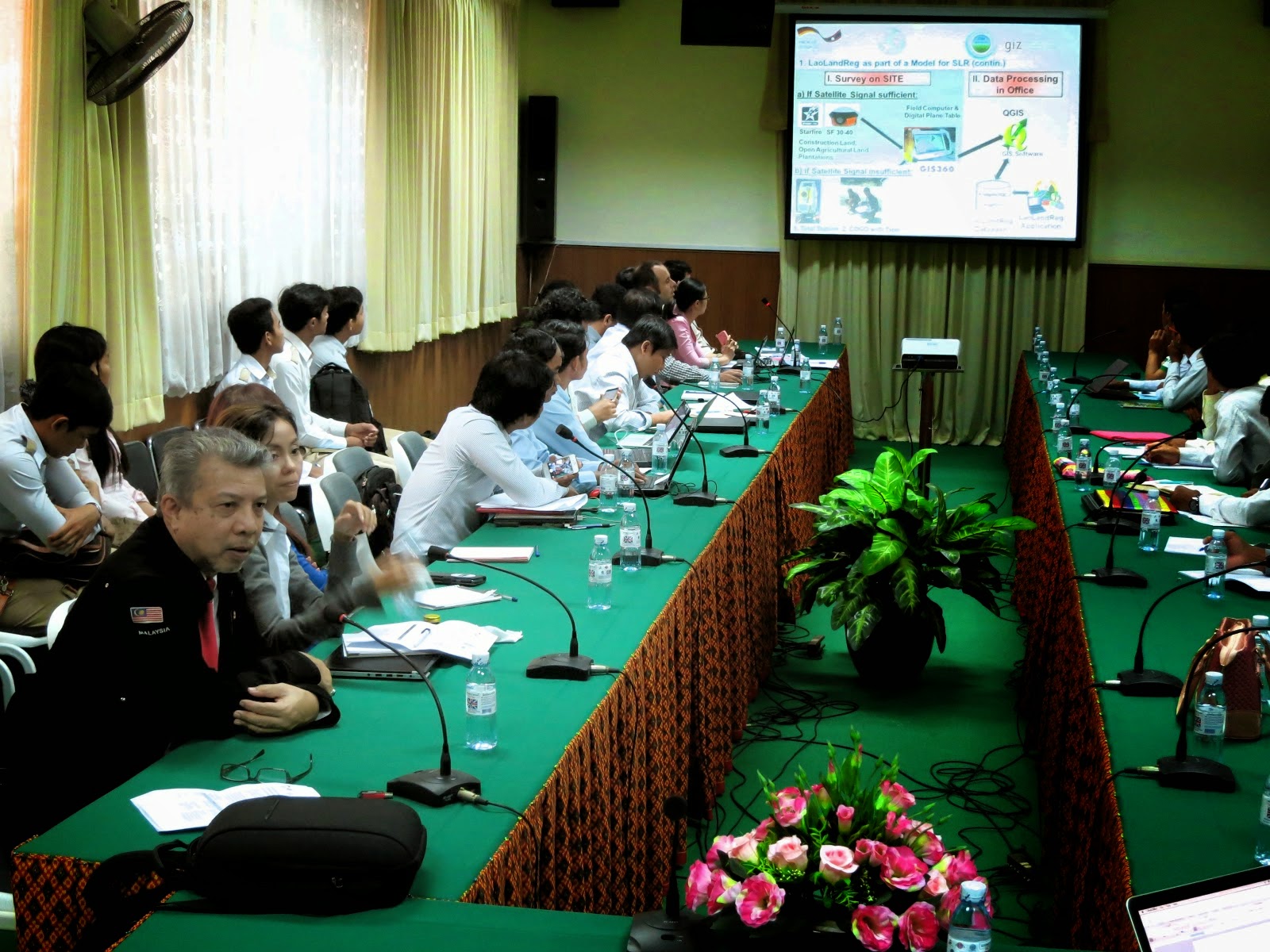
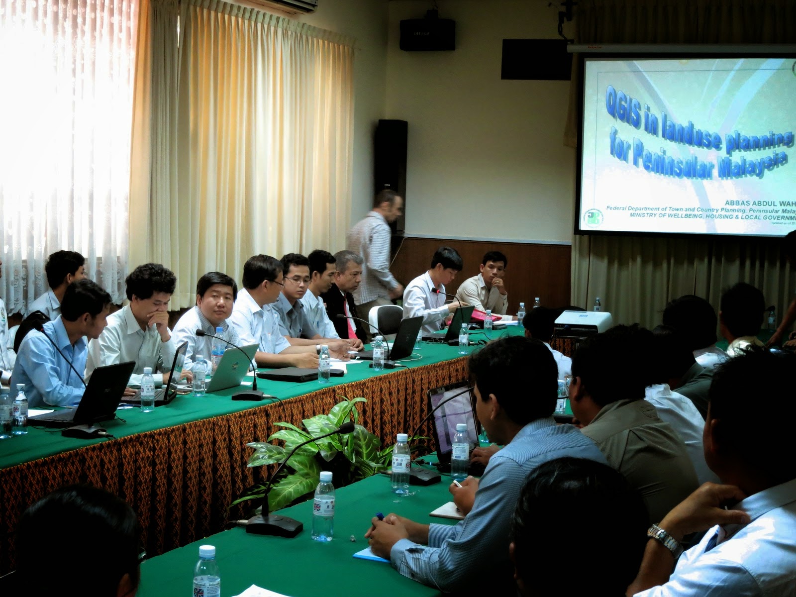
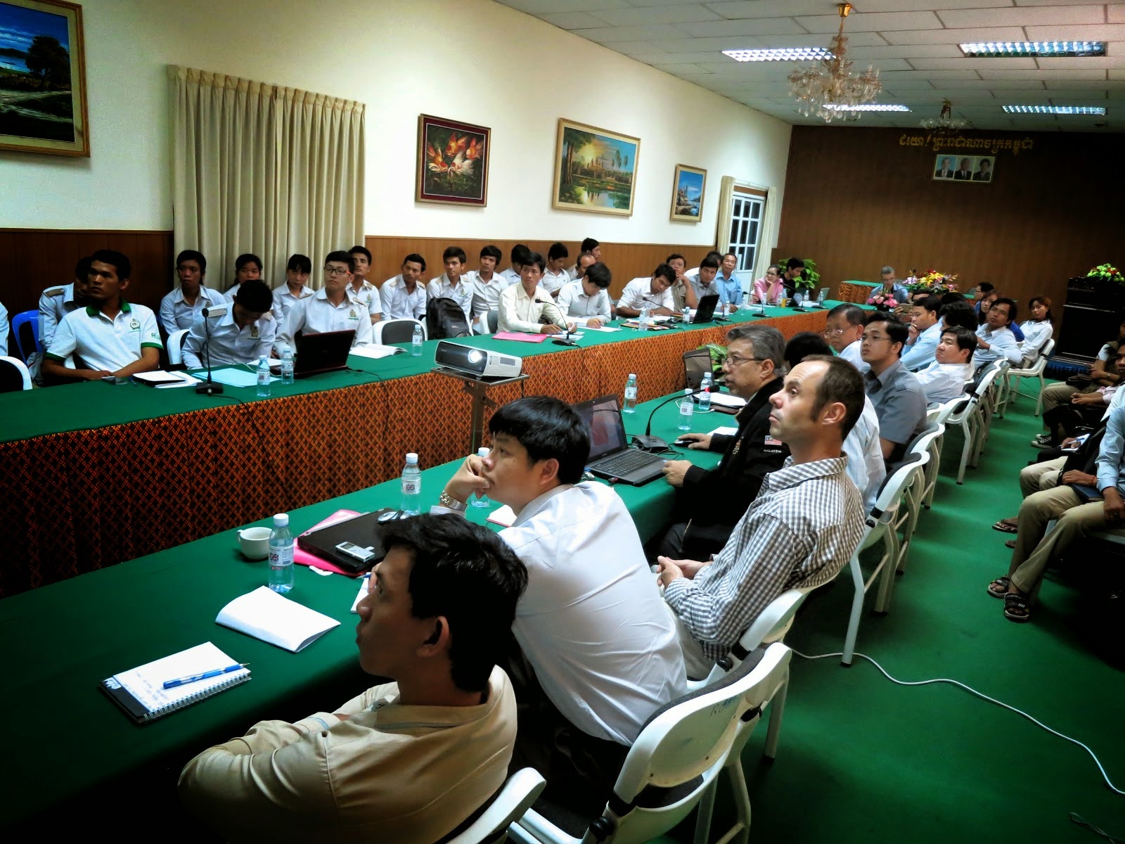
I was invited to give a talk at the above workshop organized by the Royal University of Agriculture, Cambodia in cooperation with Deutsehe Geshellschaft fur Internationale Zusammenarbeit (GIZ) GmbH. It centered on FOSS for land management and land administration with the objective to encourage the exchange of experiences and good practices, get rid of common misconceptions about FOSS and build trust in the reliability and the approach of open source software. There was a talk on the Laos Land registration System based on QGIS and PostgreSQL by Ms. Chansamai Kommanyvanh (Laos Ministry of Nat. Resources and Environment), Mr. Souksavanth Chanhtangeun and Mr. Christain Metzger (GIS Laos) After coffee break, I gave my talk on QGIS and landuse planning in Malaysia. This was followed by a talk on Geoserver implementation and integration into a website: the case study of the Open Development Cambodia website by Mr. Seila NHIEP (ODC). As we walked off for lunch, I was greeted by senior and junior participants who said they really enjoyed my presentation and found it most interesting. That pleased me a lot. After lunch, Mr. Christian Metzger talked during the workshop session on how to use the Toplogy Checker as well as plugins like MMGIS. If there was anything unfortunate, the power supply tripped 5 times during the afternoon but came back after 5 mins. I was told power failure trips are quite common in Cambodia however that day was an exception. Still, all-in-all, the Secretariat was most happy and agreed the workshop was a success where about 60 participants came and others had to be turned down because the venue could only handle a limited number of audience. I believed that with sceptics, one has to be honest about things, draw the line what QGIS can and cannot do, even clarify what desktop GIS do and cannot do then explain what alternatives are there, and lastly, the problems and challenges I faced to make the use of QGIS a success. Before this, I have been to Spain but never to Cambodia so for me, on the whole, it was most a most enjoyable trip.

06/11/2014

From PDUK to NDCDB, and away we go.


My department relies on the Survey department's (JUPEM) cadaster map in the preparation of our value-added landuse maps where we traditionally use their Solder Cassini projected cadaster maps. Since 2010, JUPEM embarked on the preparation of geodetic NDCDB cadaster maps which we welcome it because it integrates all state cadaster maps under one reference point i.e. the centre of the earth just like their topography map with its reference point at Kertau,Pahang for Peninsular Malaysia. Using my trusty QGIS, now ver 2.6, I activated Google Hybrid then all 11 state cadaster maps and was most happy to see they fit well like a jigsaw puzzle as seen in the upper image. Next, I zoom down to the point where the cadaster maps of Pahang, Negeri Sembilan and Johor meet and as shown in the lower pix, again am very pleased that JUPEM has done an excellent job. There is an issue which we found that when the PDUK 2011 was transformed to GDM2000 projection using JUPEM's parameters, it still was not a mirror reflection of NDCDB cadaster map, even found that were more lots in the PDUK 2011 than the NDCDB 2013. We have still trying to resolve this or at least compromise but one thing is for sure, the way forward is the use of the NDCDB cadaster because every new annual cadaster map produced by JUPEM is based on the geodetic map projection which to me is a sound and practical move.