27/01/2012

Installation of QGIS Android


Contributed by Fadzlan
Instalasi QGIS Android

Tertarik dengan artikel En. Abbas berkenaan QGIS Mobile, saya ambil langkah install QGIS Android ke smartphone Sony Xperia Mini saya kebetulan menggunakan OS Android 2.3.3 Ginger Bread (Ahem-ahem). 
Installation of QGIS Android

Attracted to Abbas's article on QGIS Mobile, saya took steps to install QGIS Android to my Sony Xperia Mini smartphone which happens to use Android 2.3.3 Ginger Bread (Ahem-ahem).

See the QGIS icons

 Download from http://hub.qgis.org/projects/android.qgis

Hasil:
  1. QGIS Android versi Master-Alpha 3 dipilih dan installasi berjaya tetapi ianya memerlukan perisian sokongan dari pasaran Android supaya boleh 'run'.
  2. Interface QGIS Android adalah lebih kurang sama seperti QGIS desktop. Ikon-ikon yang dipaparkan adalah sama. Terdapat ikon add PostGIS juga untuk berinteraksi dengan geodatabase.
  3. Malahan skrin smartphone saya kecil dan agak sukar untuk membuat editing. Maka nasihat saya sekurang-kurangnya menggunakan QGIS Android ini bersama skrin 7 inci (contoh Samsung tablet 7.0).
  4. Secara keseluruhan, proses installasi amat baik dan mudah. Cuma dari segi performance, saya tidak mencuba secara mendalam. Mungkin selepas ini saya akan membeli Samsung tablet disebabkan alasan diatas :-)
Dengan adanya versi QGIS Android, maka kerja-kerja melibatkan pengemaskinian data gunatanah secara live semakin mudah. Saya percaya apabila versi stabil tiba dan telah disesuaikan untuk telefon bimbit, pengguna hanya perlu membawa telefon bimbit ke tapak kajian lapangan dan pastikan jaringan adalah 3G untuk mencapai akses ke PostgreSQL-PostGIS server. Ini akan mengubah persepsi pengguna gis berlesen sekiranya mereka tahu berkenaan QGIS Android kerana berkemungkinan besar mereka juga akan menjadi pengguna Android phone/tablet kelak.  

Results:
  1. QGIS Android Version Master-Alpha 3 was chosen and installation was successful but required a supporting software from the Android market to enable it to run.
  2. The QGIS Android interface is more or less the same as the QGIS desktop. The icons availavle are the same. There is even an add PostGIS icon  to interact with a geodatabase.
  3. Unfortunately the small screen of my smartphone makes it difficult to do editing. My advice is to  at least use this QGIS Android with a 7inch screen (e.g. Samsung table 7.0).
  4. On the whole, installation was very good and simple. Except in terms of performance, I did not get to go into details. Maybe after this I might buy a Samsung tablet to justify myself :-)
With this version of QGIS Android, the task of updating landuse data live becomes easier. I believe once the stable version comes and has been adapted for the mobile phone, the user only needs to bring along a mobile phone to the site area and ensure a 3G network is available to link to a PostgreSQL-PostGIS server. This should change the perception of proprietary gis users if they were aware of QGIS Android and whom even become Android phone/table users later themselves.

QGIS Android activates itself     
Familiar QGIS work screen with test polygon added

19/01/2012

* Training: JPBD Northern Zone Project Office get trained in QGIS


Latihan: Pejabat Projek Zon Utara dapat latihan QGIS

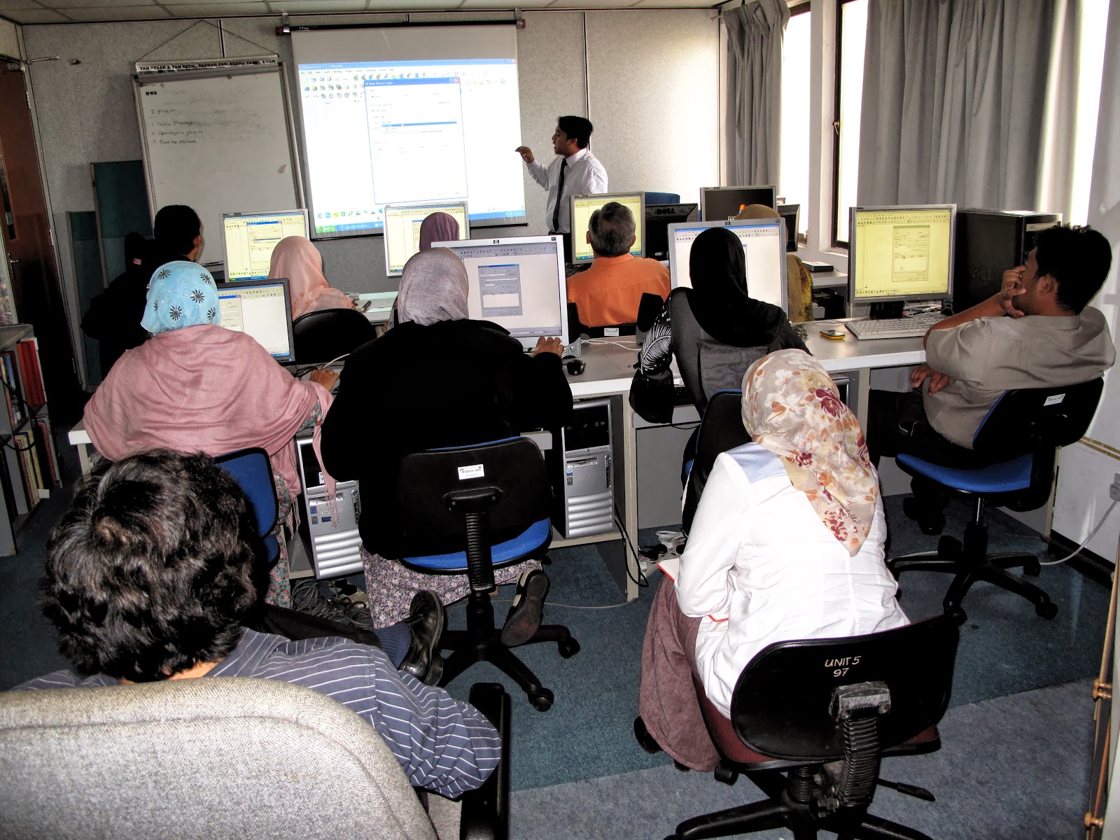
Fadzlan dan saya berada selama 2 hari di Pejabat Projek Utara (PPZU), Alor Setar pada 18-19.1.12 dan berjaya melatih seramai 20 orang dalam QGIS. Bagaimana, talian internet kurang elok maka kami tidak menunjuk kebolehan QGIS untuk mengekploitasikan Google Maps, dll. tetapi saya sempat dual boot-kan 1 komputer dengan Ubuntu kerana komputer makmal tu mengalami kerosakan sistem operasi Windows dan menyulitkan pemasangan QGIS. Apabila peserta-peserta melihat dengan mata kasar betapa laju pengguna dapat menyelari internet dengan Ubuntu, ramai yang ingin komputer masing-masing di dual boot-kan tambah pula mereka tahu QGIS juga terdapat dalam Ubuntu, lalu saya sedekahkan salinan CD Ubuntu tersebut. Sesi latihan tersebut dikatakan berjaya dalam mencapai matlamat agar kakitangan pejabat Utara akan berpindah kepada QGIS. Adalah dijangka lanjutan latihan ni, peserta-peserta latihan akan menjadi jurulatih pula bagi lain-lain pegawai disana. Saya yakin menjelang hujung tahun ni, lebih kurang 80 orang di PPZU akan menggunakan QGIS.

Maklumbalas:

Siti Salha Ishak
Very friendly, easy to manage, simple

Norhasliza Din
Easy to manage, It's a good software

Che Puan Jusoh
QGIS ini menarik. Perlu lebih masa dan kelas lanjutan

Fuziah Said
Very user friendly, simple, free of charge

Masturah Lok Ahmad
Easy to manage, it's free software

Rosli Hashim
Free software to download, easy to understand  but need more practical hands-on

Noor Azlin Anta Omar
Mesra pengguna, mudah untuk dipelajar dan fahami

Zaiton Saffiee
Program yang amat friendly bagi pengguna-pengguna GIS, perlu lebih masa untuk mempelajari sistem QGIS

Kuang
It's good for us because we cannot get propreitary software

Ovi
Quite user-friendly, takes time to learn more

Nor Zuhaizan Zulkifli
Mudah difahami bagi yang tidak mahir dengan MapInfo, senang untuk digunakan, aplikasi percuma

Siti Sarah Bakar @ Saad
Bagus sebab free download, cuma perlu libih banyak belajar untuk orang yang peringkat beginner GIS seperti saya.

Ismail Aziz
Free software, jimat-ini yang penting, kebiasaan menggunakan MapInfo jika nak guna untuk Jabatan kena buat pelarasan maklumat, mudah difahami

Ali Che Mat
Agak mudah kena kerap selalu latihan, galakkan dari pihak atasan

Ahmad Khadri Othman
User friendly, mudah dan sangat senang digunakan dalam tugas seharian (kerja-kerja gunatanah)

Mohd Hidzer Osman
Mesra pengguna, suatu perisian yang baik dan mudah dipelajari, laithan amalai perlu dibuat sekurang-kurang-nya 2 hari kerana banyak lagi ikon dan arahan yang tidak didedahkan, teknik editing seperti trim dan erase "outside" seperti MapInfo tidak dapat ditunjukkan semasa kursus berjalan.

Training: JPBD Northern Zone Project Office get trained in QGIS

Fadzlan and me spent 2 days at the Northern Project Office (PPZU) at Alor Setar on 18-19.1.12 and successfully trained 20 people in QGIS. However, the internet line was slow so we could not fully show QGIS's potential at exploiting Google Maps etc. but I managed to help dual boot a computer with Ubuntu since one of the lab computers had a faulty Windows operating system making it difficult to install QGIS. When they all saw how comparatively faster surfing on Ubuntu was, many were anxious to have their own computer dual booted also having found that a Ubuntu QGIS was also there, so I gave them my copy of Ubuntu. I would say the training session was successful in meeting the goal to get the staff to migrate to QGIS. It is expected they will later be trainers to train the rest of the staff there. I am confident that by the end of the year about 80 people at PPZU will be using QGIS.

14/01/2012

QGIS-PosgreSQL-PostGIS: The foundation of JPBD's iPlan takes shape

QGIS-PosgreSQL-PostGIS: The foundation of JPBD's iPlan takes shape

The department's iPlan is a mammoth and ambitious plan to integrate all landuse plans from different administrative tiers into a seamless integrated landuse plan namely from all local planning authorities in Peninsular Malaysia at the local government level up to all state town planning departments at the state government level up to the Fed. Dept of Town and Country Planning at the federal level. Yes, no doubt it will be an expensive project to realize but the facts of the matter is that the government is annually providing limited funds for development projects. But the show must go on so how does one go about it? Even if there are open source sceptic out there, they cannot but admit that this is the way forward. Most open source supporters know this and the recent tremendous growth of Android mobile phones is an excellent tell-tale.

The foundation to realize the iPlan is the establishment of GIS geodatabase at every planning office but this is non-existent in many especially the poorer town planning agencies. The problem can be attributed to a traditional and effective mind impression by the private sector to side line the availability of alternative GIS which from their business angle, they are doing the right thing. However, the development of open source geospatial database has been so tremendous in recent times that they have made geospatial software reasonably user-friendly to the point that non-programmers like me can now install and configure geospatial software be it GIS or database. The most important thing is that it works at with hardly any cost. I plan to repeat the whole process again from scratch to be doubly sure I can do it again with success, only then will I be really confident to give myself a good passing mark but I am confident I can do it.

Our recent success was :
  • Downloading, installing, configuring then using Ubuntu Server 32bit operating system to convert an old computer into a server;
  • Downloading, installing, configuring then using PostgreSQL-PostGIS to develop a GIS geospatial database
  • Configure the server to link with the network and make PostgreSQL viewable from within the network (This was difficult for me)
  • Downloading, installing, configuring then using PgAdmin3 to create a new database;
  • Using PgAdmin3 to convert then uploading a landuse .shp files into that database;
  • Configuring then using Quantum GIS to retrieve that landuse data then make SQL queries from the client computer. 
The next thing to do is to implement it live for our own GIS native data. After that, implement it at a state planning office. A state director has already given his full support. Lastly, implement it at a regional project office if they can supply us a server or at least a computer. Once the development of GIS geospatial database picks up among other state planning offices, we get to fully implement Phase 2 of the iPLAN. This will demand the establishment of other servers to replicate gis data up the iPLAN network. You can see how QGIS's role is in this matter and while it is only a desktop GIS, it plays a critical role in iPLAN's success because desktop(client)-server synergy is vital to the iPLAN success. I have only one reservation...I do not know if my own department has enough faith in me if I were to tell them what I want, that is, that the department must fully migrate over to QGIS. Ths is because QGIS synergizes with PostGIS as they both adhere to OSGeo  standards. Anyway, I do not know if I am still around by then.

06/01/2012

QGIS-PostgreSQL-PostGIS project successfully!

RDBMS Server
Client computer
 QGIS-PostgreSQL-PostGIS project successfully!

Bulan lepas, satu server dipasangkan Ubuntu Server 64bit, PostgreSQL-PostGIS & PgAdminIII termasuk RDBMS pangkalan data geospatial. Server itu sekarang terletak dibilik saya. Semalam perunding menkonfigurasi setting jaringan bagi Dell PowerEdge T11 sewaan lalu menggunakan Pgadmin di komputer saya. Malahan tepat waktu itu boss panggil dan tak dapat lah saya lihat apa yang beliau buat pada Pgadmin. Kemudian, saya aktifkan QGIS dan kita bersama-sama muat naikkan 3 lapisan peta ke GIS: 2 peta rancangan struktur negeri dan 1 peta rancangan tempatan daerah. Semua berjalan dengan lancar. Saya yakin semua akan berjalan dengan baik. Bagaimana map projection menguasai pengintegrasian peta guntanah jelas dimana hasilnya kurang elok apabila map projection tidak sama seperti antara rancangan-rancangan struktur negeri tetapi berjalan dengan baik seperti gambar diatas bagi peta gunatanah daerah yang terletak atas rancangan struktur negeri. Saya berharap dapat duplikasi langkah ini dengan komputer pejabat yang telah saya server-kan tetapi buat masakini masih merangkak dengan setting jaringan kerana memerlukan bauntan disini.

QGIS-PostgreSQL-PostGIS project successfully!

Last month, a server was made to run on Ubuntu Server 64bit installed with PostgreSQL-PostGIS & PgAdminIII inclusive of a RDBMS geospatial data. That server now sits in my room. Yesterday, a consultant configured the network setting of the rented Dell PowerEdge T11 then went over to my computer and used Pgadmin. Alas, timing was bad and I was called by my boss so I did not see what he did with Pgadmin. Later, I activated QGIS and together we loaded 3 map layers into QGIS: 2 state structure plans and 1 district local plan. Everything worked like a breeze. I am confident everything will work out smoothly. How map projections dictates the integration of landuse maps is obvious where they show up badly when they do not stick to the same map projection such as between state structure plans of different map projection but work fine as in the picture above showing a district landuse map over a state structure plan. I am hoping to duplicate this act later with an office computer that was server-ed but for the moment, am fumbling with the network setting as I need help here.

03/01/2012

* QGIS Mobile


Mobil QGIS

Menjelang tahun lalu, saya masih teringat pihak atasan menyuarakan perlunya ada Mobil GIS dan andainya jabatan tidak menumpu ke arah Mobil GIS, maka bahagian yang bertanggungjawab  mempromosikan Mobil GIS bagi Jabatan dilihat kurang berkesan atau tidak menjalankan tanggungjawabnya, tak kisah, sama ada teknologi masakini adalah matang ke tidak. Oleh itu, dalam beberapa hari yang lalu, saya telah melayari serta menumpu perhatian bagi Mobil GIS yang utamakan QGIS. Wow, sukahati saya mendengar Mobil GIS khususnya QGIS untuk Android telah pun dibangunkan sejak 21.8.2011. Maka itu, untuk rujukan masa hadapan telah saya simpankan pautan-pautan seperti berikut:
Secara peribadi, saya amat kagum dengan pasukan Mobil QGIS yang diketuai oleh En. Marco, tabik. Seterusnya, soalan terpenting adalah ... "Bilakah akan saya melabur memperolehi telefon bimbit jenis Android?"

QGIS Mobile


Late last year, I recalled the top management were all abuzz with GIS mobile as if the department does not venture into GIS mobile, then the principal division responsible in promoting GIS for the department is inefficient or not doing its job let alone whether the technology is matured or still in R&D. So, during this past few days, I did some surfing and in favour of QGIS, decided to search of a QGIS Mobile. Wow, thankfully a QGIS Mobile or specifically for QGIS for Android just got developed, a working version existed since 21.8.2011. Thus, for future reference, I am keeping the links here:

Personally I am very impressed by the QGIS Mobile team headed by Mr. Marco, I really take my hat of to them. Next, the more important question ... "When shall I invest in a worthy Android mobile phone?"